Introduction
The Faroe Islands are a beautiful group of islands in the North Atlantic Ocean. They sit between Iceland, Scotland, and Norway. The islands are famous for green mountains, deep fjords, waterfalls, cliffs, and peaceful villages. The scenery can look almost magical when clouds move across the hills. The islands feel remote, but getting there is easier than many travelers expect. Flights connect the destination with several European cities. Ferry services are also available. There are 18 main volcanic islands, with many connected by roads, bridges, tunnels, and ferries. The capital is Tórshavn. This guide explains the main things travelers should know before visiting. It covers the faroe islands map, flights, weather, hiking, transport, food, accommodation, and useful travel tips.
Faroe Islands Quick Facts
Before planning your trip, learn a few basic facts. The Faroe Islands cover about 1,399 square kilometers. The archipelago has 18 volcanic islands. The highest mountain is about 880 meters high. The capital city is Tórshavn. The main airport is Vágar Airport. Faroese is the main language, while Danish is also official. The climate is cool and changeable. Rain, fog, wind, and sunshine can appear during the same day. The local currency is the Faroese króna, which has the same value as the Danish krone. These details can help you prepare for your journey.
| Detail | Information |
|---|---|
| Destination | Faroe Islands |
| Location | North Atlantic Ocean |
| Main Islands | 18 volcanic islands |
| Capital | Tórshavn |
| Land Area | About 1,399 km² |
| Highest Peak | About 880 meters |
| Main Airport | Vágar Airport |
| Airport Code | FAE |
| Main Language | Faroese |
| Currency | Faroese króna / Danish krone |
| Climate | Cool and changeable |
| Popular Activities | Hiking, photography, sightseeing |
Where Are the Faroe Islands?
The Faroe Islands are located in the North Atlantic Ocean. They are positioned between Iceland and Scotland. Norway is also relatively close. Their northern location creates a cool climate throughout the year. The Gulf Stream helps keep temperatures milder than expected. The landscape was shaped by volcanic activity and erosion. This created steep mountains, narrow valleys, dramatic cliffs, and beautiful coastal views. Travelers can often see mountains rising directly from the ocean. A short drive can take you from a quiet village to a dramatic viewpoint. This combination of mountains and water makes the destination very special.
Understanding the Faroe Islands Map
A detailed faroe islands map is useful when planning your route. The islands may look small, but travel can take time. Vágar is home to the main airport. Streymoy contains Tórshavn and connects with several other areas. Eysturoy has mountains, villages, and scenic roads. The Northern Isles provide quieter landscapes and small communities. Sandoy and Suðuroy offer more remote experiences. Many islands are connected by tunnels and bridges. Others require ferries or boats. Studying a faroe islands map before your trip helps you understand distances. It can also help you choose where to stay and which places to visit.
Finding Flights to the Faroe Islands
Searching for flights to faroe islands is an important part of trip planning. Vágar Airport is the main international airport. Atlantic Airways operates many services to the islands. Other airlines also provide connections from selected European destinations. Copenhagen is an important travel hub for visitors. Routes can also connect through Iceland, Norway, and other locations. Flight schedules can change during different seasons. Summer often provides more travel choices. When comparing flights to faroe islands, check baggage rules and connection times. Booking early can also give you more options. Always check the latest schedule before finalizing your travel plans.
What Is the Best Time to Visit?
The best travel season depends on your plans. Summer is popular because daylight hours are long. The green landscape also looks especially beautiful during this period. Spring and autumn can provide quieter roads and changing scenery. Winter has shorter days and stronger weather conditions. Rain and wind are possible during every season. Weather can change quickly, so flexible planning is important. Pack warm layers and waterproof clothing. Good walking shoes are also useful. If you plan to hike, check the weather before leaving. Avoid making every day depend on one outdoor activity. A flexible itinerary gives you better options when conditions change.
Best Places to See
The Faroe Islands have many beautiful places to explore. Tórshavn is a natural starting point for many visitors. It has restaurants, shops, harbor views, and historic areas. Saksun is known for its peaceful valley and dramatic scenery. Gjógv has a natural harbor surrounded by mountains. Vágar offers several famous landscapes and is convenient after arriving at the airport. The Northern Isles are useful for travelers seeking quieter areas. Try not to rush between attractions. Some of the best memories can come from small villages and roadside viewpoints. Leave time to stop, take photos, and enjoy the scenery. A slower itinerary often makes the trip more enjoyable.
Hiking and Outdoor Adventures
Hiking is one of the most popular ways to experience the Faroe Islands. Trails can lead across green hills, beside cliffs, and through peaceful valleys. The views can be spectacular. However, mountain conditions can change quickly. Rain can make paths slippery. Fog can reduce visibility, while strong winds can create serious risks. Wear shoes with good grip and bring waterproof clothing. Check trail information before starting your hike. Some routes may have access rules or fees. Never get too close to cliff edges for photographs. Tell someone about your route when hiking in remote areas. Bird watching is another enjoyable activity, especially around coastal cliffs.
Getting Around the Islands
Getting around the Faroe Islands is easier than the landscape may suggest. Roads connect many communities. Bridges and tunnels connect several islands. Rental cars provide flexibility for independent travelers. Buses and ferries are also available. Your best option depends on your itinerary. A rental car lets you stop at viewpoints and small villages. Public transport can work well for visitors staying around larger towns. Check ferry schedules before traveling to smaller islands. Services may be less frequent during certain periods. A good faroe islands map helps you understand which areas require roads, tunnels, buses, or ferries.
Food You Should Try
Food is another interesting part of visiting the Faroe Islands. Local cuisine is closely linked to the sea and farming traditions. Seafood is an important part of the local diet. Restaurant menus may include fish, salmon, shellfish, and other seafood. Lamb is also common because sheep have long been important to island life. Traditional dishes can have strong flavors. Modern restaurants often combine local ingredients with Nordic cooking. Tórshavn has the widest selection of restaurants. Smaller villages may have fewer choices. If you want to try local food, ask about seasonal dishes. Food provides a simple way to learn about local culture while enjoying your trip.
Exploring Tórshavn
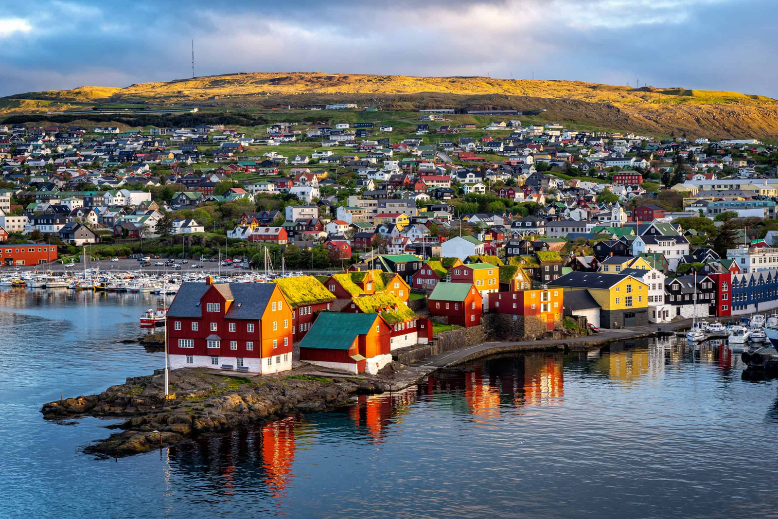
Tórshavn is the capital and an important base for travelers. The city is small but offers plenty to explore. The old harbor area is especially interesting. Tinganes has traditional red wooden buildings and narrow streets. Visitors can explore cafés, shops, and local sights. Tórshavn is also useful for day trips around nearby areas. Staying there gives you easy access to restaurants and other services. The city provides a nice contrast to the remote countryside. Even on a short trip, spending time in the capital can help you understand modern Faroese life and traditional culture.
Where Should You Stay?
Your accommodation choice depends on your travel style. Tórshavn is useful if you want restaurants, shops, and transport options nearby. Vágar can be convenient for travelers who want to stay close to the airport. Smaller villages provide a quieter experience. Guesthouses can offer a more personal atmosphere, while apartments can suit families or longer stays. Think about driving times when choosing accommodation. A location that looks close on a map may take longer because of roads and weather. Booking early can provide more choices. Check parking, transport, food options, and cancellation rules before booking.
How Long Should You Stay?
A three-day trip can provide a quick introduction to the Faroe Islands. Four or five days gives you more time for villages, hiking, and scenic drives. A week allows you to travel at a slower pace. Extra days are useful because weather can change outdoor plans. Instead of filling every hour, choose a few important places each day. Leave time for unexpected stops and beautiful viewpoints. A relaxed schedule can make the journey more enjoyable. Longer trips also give you more opportunities to experience local food and village life.
Photography Tips
The Faroe Islands offer excellent scenery for photography. Mountains, cliffs, waterfalls, villages, and clouds create many interesting scenes. Morning and evening light can produce beautiful landscape photographs. Fog can also create dramatic views. Always keep a safe distance from cliff edges. Strong winds can be dangerous even when the weather looks calm. Protect your camera from rain with a suitable cover or bag. A wide-angle lens can capture large landscapes. A standard lens works well for villages and smaller details. Remember to enjoy the scenery without spending the entire trip behind your camera.
Final Thoughts
The Faroe Islands offer mountains, ocean views, quiet villages, and dramatic landscapes. A useful faroe islands map can make route planning much easier. Checking flights to faroe islands early can also simplify your trip. Start with a simple itinerary and leave space for changing weather. Pack waterproof clothing, warm layers, and comfortable shoes. Respect local safety rules, especially when hiking near cliffs. Whether you visit for three days or one week, focus on enjoying the journey. The islands may be small, but they offer many memorable experiences for travelers who enjoy nature and peaceful surroundings.
Frequently Asked Questions
1. Where are the Faroe Islands?
The Faroe Islands are in the North Atlantic Ocean. They are located between Iceland and Scotland. Norway is also nearby. The archipelago contains 18 volcanic islands.
2. How can I reach the Faroe Islands?
You can travel by air or ferry. Vágar Airport is the main international airport. Flights connect the islands with several European locations. Ferry services are also available.
3. What should I visit?
Tórshavn, Vágar, Saksun, Gjógv, Eysturoy, and the Northern Isles are popular choices. Your route should depend on your available time and weather conditions.
4. Do I need a car?
A car is not essential. Buses and ferries connect many areas. However, renting a car can provide more freedom for scenic stops and remote villages.
5. What is the weather like?
The weather is cool and changeable. Rain, wind, fog, and sunshine can appear quickly. Waterproof clothing and warm layers are useful throughout the year.
6. Are the Faroe Islands good for first-time visitors?
Yes. Basic planning can make the trip simple. Check transport, accommodation, weather, and hiking information before traveling. A flexible schedule is especially helpful.